Kokopo
Kokopo is the capital of East New Britain Province in Papua New Guinea. It is administered under Kokopo-Vunamami Urban LLG. The capital was moved from Rabaul in 1994 when the volcanoes Tavurvur and Vulcan erupted. As a result, the population of the town increased more than sixfold from 3,150 in 1990 to 20,262 in 2000.
Kokopo was known as Herbertshöhe (Herbert's Heights), named in honour of Herbert, eldest son of German Chancellor Otto von Bismarck, during the German New Guinea administration, which controlled the area between 1884 and formally until 1919. Until 1910, it was the capital of German New Guinea.
On Sunday, March 29, 2015, a strong earthquake, of a preliminary magnitude of at least 7.5, which at that time was the largest earthquake of 2015, was recorded near Kokopo, and a tsunami warning was issued. This was surpassed a month later by the April 2015 Nepal earthquake, which measured a magnitude 7.8.
In 2015, a research and conservation project was suggested to study and protect spinner dolphins living around Kokopo beach, as this population may be threatened if construction of a new port for larger shipping lanes is initiated.
The remains of the former capital Rabaul are located some 20 km to the north-west of Kokopo, when using the Kokopo-Rabaul Highway. There are around 4,000 inhabitants in Rabaul, down from over 17,000 before the latest volcanic eruption.
Rabaul Airport (also called "Tokua Airport"), one of Papua New Guinea's largest domestic airports, is located a few kilometres east of Kokopo.
Map - Kokopo
Map
Country - Papua_New_Guinea
 |
 |
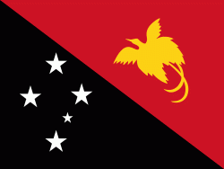
| Flag of Papua New Guinea | |
At the national level, after being ruled by three external powers since 1884, including nearly 60 years of Australian administration starting during World War I, Papua New Guinea established its sovereignty in 1975. It became an independent Commonwealth realm in 1975 with Elizabeth II as its queen. It also became a member of the Commonwealth of Nations in its own right.
Currency / Language
| ISO | Currency | Symbol | Significant figures |
|---|---|---|---|
| PGK | Papua New Guinean kina | K | 2 |
| ISO | Language |
|---|---|
| EN | English language |
| HO | Hiri Motu language |


